For the past several years, volunteers have been transcribing vital record data from resources held in the Belfast Free Library Special Collections. These include Waldo County town reports, historic records of the First Church, Coombs Funeral Home records, Republican Journal death notices, and various other sources of birth, marriage and death information.
The town report database and First Church database are currently available for your use.
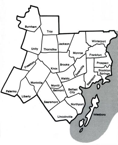
Brief History of Waldo County
Waldo County was formed in 1827 from lands in Hancock and Lincoln counties. In 1860, land was set off to create Knox County. Today the county has a total area of 853 square miles, of which 14% is water (lakes and rivers).
In 1630, England granted a grant of land called the Muscongus Patent to enable trading with the local Indian populations. When the Indian Wars started in 1675, trading stopped and the patent lay dormant until 1719. By then the patent had descended to Thomas Leverett who was then the president of Harvard College. He formed a group of ten Massachusetts men called the Lincolnshire Proprietors and lay claim to the land. They hired General Samuel Waldo (1696-1759) as their land agent for the area. He acquired a controlling interest in 1729, at which time it became known as the Waldo Patent. Waldo, a Boston merchant and land speculator, also served as a brigadier-general during King George's War (1744-1748), one of the Indian Wars in America.
Waldo County was formed in 1827 from lands in Hancock and Lincoln counties. In 1860, land was set off to create Knox County. Today the county has a total area of 853 square miles, of which 14% is water (lakes and rivers).